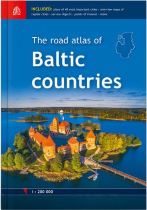
First edition in scale 1:200 000
City and town plans in scale 1:20 000 - 1:100 000
Size 14 x 24 cm
For the first time the road atlas of the Baltic countries is published at scale 1: 200 000. It is the most detailed map atlas covering the entire territory of the Baltic States. Atlas has a new, larger format and a hardback cover.
Atlas basemap is supplemented with plans of the 48 largest cities at scale 1: 20 000 as well as Tallinn, Riga and Vilnius vicinity maps at scale 1: 85 000. The reader will find the Baltic Sea region map in the introduction section, and place name index in the final section.
For travellers information about points of interest and tourism services will be useful.
Map legend in Estonian, Latvian, Lithuanian, English, German and Russian language.
Первое издание в масштабе 1:200 000
Масштаб планов городов 1:20 000 - 1:100 000
Размер 14 x 24 см, 166 страниц
В сравнении с предыдущим изданием атлас имеет новый, более детальный масштаб (ранее - 1:500 000), несколько больший размер и ламинированную обложку для более долгого использования. Карта автодорог Латвии, Эстонии, Литвы и Калининградской области в масштабе 1:400 000 разделена на 81 страницу. Основную карту атласа дополняют 52 обзорных плана наиболее важных городов в масштабе от 1:50 000 до 1:100 000, а также планы центра Таллина, Риги и Вильнюса в масштабе 1:20 000. Вводная часть включает в себя карту региона Балтийского моря, а заключительная - алфавитный указатель названий всех населенных пунктов, видимых на карте. На отвороте обложки атласа указаны обозначения на картах и таблица расстояний между крупнейшими городами Прибалтики.
На карте улучшена читаемость информации, обновлена информация об автодорогах, населенных пунктах, объектах придорожного сервиса и туристических объектах. Полностью переработаны планы населенных пунктов (особое внимание уделено городам Эстонии и Литвы), уточнены изменения относительно улиц и застройки, расположение объектов придорожного сервиса и туристических объектов.
For the first time the road atlas of the Baltic countries is published at scale 1: 200 000. It is the most detailed map atlas covering the entire territory of the Baltic States. Atlas has a new, larger format and a hardback cover.
Atlas basemap is supplemented with plans of the 48 largest cities at scale 1: 20 000 as well as Tallinn, Riga and Vilnius vicinity maps at scale 1: 85 000. The reader will find the Baltic Sea region map in the introduction section, and place name index in the final section.
For travellers information about points of interest and tourism services will be useful.
Map legend in Estonian, Latvian, Lithuanian, English, German and Russian language.
Pervoe izdanie v masshtabe 1:200 000
Masshtab planov gorodov 1:20 000 - 1:100 000
Razmer 14 x 24 sm, 166 stranits
V sravnenii s predyduschim izdaniem atlas imeet novyj, bolee detalnyj masshtab (ranee - 1:500 000), neskolko bolshij razmer i laminirovannuju oblozhku dlja bolee dolgogo ispolzovanija. Karta avtodorog Latvii, Estonii, Litvy i Kaliningradskoj oblasti v masshtabe 1:400 000 razdelena na 81 stranitsu. Osnovnuju kartu atlasa dopolnjajut 52 obzornykh plana naibolee vazhnykh gorodov v masshtabe ot 1:50 000 do 1:100 000, a takzhe plany tsentra Tallina, Rigi i Vilnjusa v masshtabe 1:20 000. Vvodnaja chast vkljuchaet v sebja kartu regiona Baltijskogo morja, a zakljuchitelnaja - alfavitnyj ukazatel nazvanij vsekh naselennykh punktov, vidimykh na karte. Na otvorote oblozhki atlasa ukazany oboznachenija na kartakh i tablitsa rasstojanij mezhdu krupnejshimi gorodami Pribaltiki.
Na karte uluchshena chitaemost informatsii, obnovlena informatsija ob avtodorogakh, naselennykh punktakh, obektakh pridorozhnogo servisa i turisticheskikh obektakh. Polnostju pererabotany plany naselennykh punktov (osoboe vnimanie udeleno gorodam Estonii i Litvy), utochneny izmenenija otnositelno ulits i zastrojki, raspolozhenie obektov pridorozhnogo servisa i turisticheskikh obektov.
For the first time the road atlas of the Baltic countries is published at scale 1: 200 000. It is the most detailed map atlas covering the entire territory of the Baltic States. Atlas has a new, larger format and a hardback cover.
Atlas basemap is supplemented with plans of the 48 largest cities at scale 1: 20 000 as well as Tallinn, Riga and Vilnius vicinity maps at scale 1: 85 000. The reader will find the Baltic Sea region map in the introduction section, and place name index in the final section.
For travellers information about points of interest and tourism services will be useful.
Map legend in Estonian, Latvian, Lithuanian, English, German and Russian language.